|
Recent
Publications relevant to
East Anglian Earth Science
GeoBritannica: Geological landscapes and the British peoples. Publication date 24 November 2016
GeoBritannica concerns the geological legacy of Britain, an inheritance bequeathed by its bedrock to the peoples who have lived on the island for the eleven millennia since the Ice Ages. The authors explain the geological foundations of the landscape and the raw materials it provides. They show how this geology has been utilised by society and by individuals in creative acts of the imagination. The reader will discover how regional environments and interests have been tackled by geologists in endeavours as diverse as mining, quarrying, architecture, literature and the visual arts.
The authors provide a modern interpretation of the geological history of Britain and place this in its historic, social and artistic contexts. Why is geology so fascinating to us? How do geologists do their science? Why are there differing landscapes in these islands and what forces, human and natural, made them the way they are? What is the nature of the geological foundations of the British
landscapes? How have geological discoveries developed our understanding of the landscape of Britain over the past two hundred years? What is the geological context of the raw materials used in past and present industries and for historic and vernacular buildings? How have geological landscapes and materials influenced past and present architects, visual artists and writers?
This is a book for those wanting to develop a better understanding of where we live and how we develop our love and understanding of the island which we inhabit.
Mike Leeder is an award winning geologist who is Professor Emeritus of the School of Environmental Sciences, University of East Anglia. Joy Lawlor is an English graduate, award winning art teacher, art therapist and artist.
Outline Contents (Full contents available on the Dunedin website):
Part 1: the Little Space of this our Island; Part 2: Assembling the Geological Jigsaw; Part 3: Remembrance of Things Past; Part 4: Material GeoBritannica; Part 5: Mineral GeoBritannica; Part 6: To show to the world what exists in nature; Part 7: GeoRegions. Glossary. Bibliography and Further Reading. Index.
Hardback: ISBN 9781780460604 (page size: 260 x 200) c. 320pages, illustrated in colour throughout
Published prices: £24.99/ 35.00/ US$40.00 GeoBrittanica will also be available as an eBook.
Order on line at www.dunedinacademicpress.co.uk and use the code DAP15 at checkout for a 15% discount that applies to the published prices of the book. Despatch and packing will be calculated and charged at our standard rates
(offer not open to customers in the USA and Canada who should order from www.isbs.com).
Dunedin Academic Press Ltd, Hudson House, 8 Albany Street, Edinburgh, EH1 3QB
www.dunedinacademicpress.co.uk
Tel. 0131 473 2397
Neanderthals Among Mammoths - Excavations at Lynford Quarry, Norfolk.
Edited by William A Boismier, Clive Gamble and Fiona Coward.
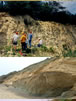
In spring 2002 mammoth bones and stone tools were discovered in situ at Lynford Quarry, near Munford village, Norfolk, UK. The finds lay within rich organic sediments of an ancient stream channel. It was immediately realised that Lynford was a site of great international significance for the study of the most distinctive of human ancestors, Neanderthals. A detailed archaeological excavation was undertaken with support from Ayton Asphalte, the quarry owners, and English Heritage, funded through the Aggregates Levy Sustainability Fund (ALSF). A large team of archaeologists and quaternary scientists recovered exceptionally well-preserved Palaeolithic and palaeoenvironmental information. More than 1,000 mammoth bones representing at least 11 individuals were excavated along with other fauna and more than 2,500 stone artefacts. Among these the large number of complete and broken handaxes marks Lynford as special in the Palaeolithic of Britain and northern Europe. The quality of the preservation made it possible to undertake full investigation of the way the deposits had been formed and how the animal bones and stones tools had come to be incorporated in them. The association of woolly mammoth bones with Middle Palaeolithic bifaces, including distinctive bout coupé handaxes, and the wealth of palaeoecological data mammal remains, beetles, pollen and mollusca make Lynford the most important British site for studying when and how Neanderthals occupied the cold, open environments of what 60,000 years ago was a peninsula of north-west Europe. These data provide a unique opportunity to investigate questions of Neanderthal hunting strategies and patterns of land use and to draw wider conclusions about their social structure in a demanding region of Ice Age Europe.
ISBN 978 1 84802 063 4
You can now download this 529-page book as a PDF for free! (A new hard copy costs £100). Use this web address for details:
http://www.english-heritage.org.uk/publications/neanderthals-among-mammoths
A Celebration of Suffolk Geology - GeoSuffolk's 10th Anniversary volume.
Edited by Roger Dixon
VONTENTS
Foreword: The Earl of Cranbrook
GeoSuffolk a decade of achievement. Compiled by Roger Dixon and Caroline and Bob Markham
A FOUNDATION
Geodiversity, Suffolk: an introductory excursion. Tim D Holt-Wilson
Suffolk geology: my first impressions. Ann Ainsworth
Suffolk Geology for Children Susan Brown
The U3A in Suffolk. Derek Barbanell
A history of geoconservation in Suffolk. Jonathan G Larwood
From Pipe Rock to the Pleistocene: a working journey through the geological record. Jeff Redgrave
Life, the Universe and Sutton Knoll. Barry Hall
Remarks on Natural History in East Anglia and the Quaternary. Richard West
Prehistoric Attitudes: A Suffolk Pedigree. Steven Plunkett
THE STRATIGRAPHY
Brief description of Silurian rock from the Stutton borehole. Roger Dixon
The Chalk of Suffolk Mark A. Woods, Rory N. Mortimore and Christopher J. Wood
Field Guide to the Harwich Formation and Pleistocene Deposits of Harkstead Shore. Bill George
Why look again at the Coralline Crag? Mainly a Molluscan Story. P.E.Long and J.A.Zalasiewicz
Bryozoans from the Pliocene Coralline Crag of Suffolk: a brief review Paul D Taylor & Anna B. Taylor
The Red, Norwich and Wroxham Crags of Northern Suffolk. Richard Hamblin and James Rose
An Arctic ostracod fauna from the Pre-Ludhamian (late Pliocene to early Pleistocene) Red Crag Formation at Buckanay Farm, Suffolk, England. Adrian Wood
The Chicken Pit at Sutton Knoll: Boulder Bed excavation, Preliminary Report. Ann Ainsworth and John Hudson
Biotic interaction in the Suffolk Crags. Elizabeth M Harper
Burrowing into the past: history of research on the Norwich and Weybourne Crag voles (Arvicolidae, Rodentia). David F Mayhew
The Norwich Crag geology of the country around Westleton. Howard B Mottram
Determining Macoma species from the Crag: balthica, calcarea, obliqua, or anyone for praetenuis? Peter Norton
Preglacial rivers (Thames, Bytham), palaeosols, and early humans in Suffolk, UK. James Rose, Richard Hamblin and Peter Allen.
The genesis and significance of the Middle Pleistocene glacial meltwater and associated deposits in East Anglia. P.L.Gibbard and P. van der Vegt
Deducing Glacier Behaviour in Suffolk. Peter Allen
Scandinavian Indicators in East Anglias pre-Glacial Succession Peter G. Hoare
The Palaeolithic Archaeological Record of Suffolk Simon G Lewis
SOME GEOMORPHOLOGY
Gulls of East Suffolk. Caroline Markham
The Orford Ness Shingle Geomorphology and Geology. Christopher Green and Duncan McGregor
The Havergate Island Hydrograph Anomaly. S J Linford-Wood
FLORILEGIUM
A model of the Ipswich urban area: geological mapping in 3D. Steve Mathers
Two Road Embankments over Peat in East Suffolk. Peter J Cearns and Michael G Burch
The UEA series of research boreholes (1968-1970) in the pre-glacial Pleistocene of East Anglia. Alan Lord
A Short History of Geology at Ipswich Museum. Bob Markham
Suffolks First Earth Scientists: Arthur Young (1741-1820) and Richard Cowling Taylor (1789-1851). Peter Banham
GeoSuffolk and building stone trails Roger Dixon
Suffolk Field Trips: how to get there, what to eat, who to eat it with and where! Bob Markham
The Pliocene Deli a culinary trawl through the Red Crag. Roger Dixon
The GeoSuffolk Archive Collection compiled by Roger Dixon
The GeoSuffolk 10th Anniversary Volume Sponsors
This volume costs £20, and is available by calling in person at the Reg Driver Centre,
Christchurch Park, Ipswich. It may also be bought at the Ipswich Museum, High Street, Ipswich, Suffolk, IP1 3QH.
If calling at the museum for your copy then please ask at the information desk for Gen Broad, Ann Ainsworth or Martin Sanford.
To obtain a copy by post please email your enquiry to info@geosuffolk.co.uk As this is a heavy, large format publication, post and packing will require an extra £8.
All cheques should be made payable to 'GeoSuffolk'.
See:
http://www.geosuffolk.co.uk
The phylogeny and palaeozoogeography of cold-water species of ostracod (Crustacea) from the Pre-Ludhamian Stage (late Pliocene-early Pleistocene), Red Crag Formation, East Anglia, England; with reference to the earliest arrival of Pacific species
Paleontological Research, vol. 13, no. 4, pp. 1–22, December 31, 2009
ADRIAN M. WOOD
We have had a very interesting lecture from this Author. His research has obviously proceeded further. It is obvious that very early cold periods had an effect on the North Sea. The following is a short abstract of his abstract.
The Pliocene Epoch represents a significant period in the palaeozoogeography of North Atlantic,
A climate crash during Marine Isotope Stage (MIS) G6 (c.2.74 Ma) resulted in the extinction of early-mid Pliocene thermophilic ostracods and the subsequent emergence of oligothermal assemblages during the late Pliocene. During the numerous cold stages of the late Pliocene-early Pleistocene Arctic ostracod species were able to disperse southwards into the mid-latitudes of the North Atlantic. The Pre-Ludhamian Stage of the Red Crag Formation, Suffolk, England spans one such episode (c. 2.7–2.41 Ma) and thus offers new insight into the vagility of shallow marine ostracods as they responded to glacio-eustatic and isostatic change.
Adrian is such a good speaker that I hope he can give us another lecture next season [ET]
Biostratigraphic and aminostratigraphic constraints on the age of the Middle Pleistocene glacial succession in north Norfolk, UK
J. Quaternary Sci., Vol. 24 pp. 557–580, 2009
Preece, R. C., Parfitt, S. A., Coope, G. R., Penkman, K. E. H., Ponel, P. and Whittaker, J. E.
This very comprehensive paper obviously documents some very comprehensive research. I will not attempt to review it here. However I must point out that the contribution by Kirsty Penkman in particular is well worth serious consideration. I am an admirer of the rigorous nature of her research techniques and thus I give credence to her finding consistent with the whole of the section concerned being of Anglian age (MIS 12). This finding is in apparent contradiction to the previously published conclusions by Prof Rose et al. of evidence for an earlier glaciation such as in MIS 16. [ET]
|